Jacques-Cartier National Park: The Self-Drive Valley 30 Minutes North Of Quebec City
Half an hour of highway separates the cobbles from a glacial valley 550 metres deep. You can explore independently or join a guided hiking or snowshoeing trip with city transport.
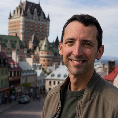 Written with Jean-Pierre Tremblay, Quebec City tour guide & heritage specialist
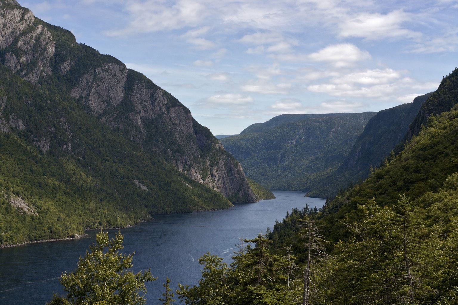
What is Parc national de la Jacques-Cartier?
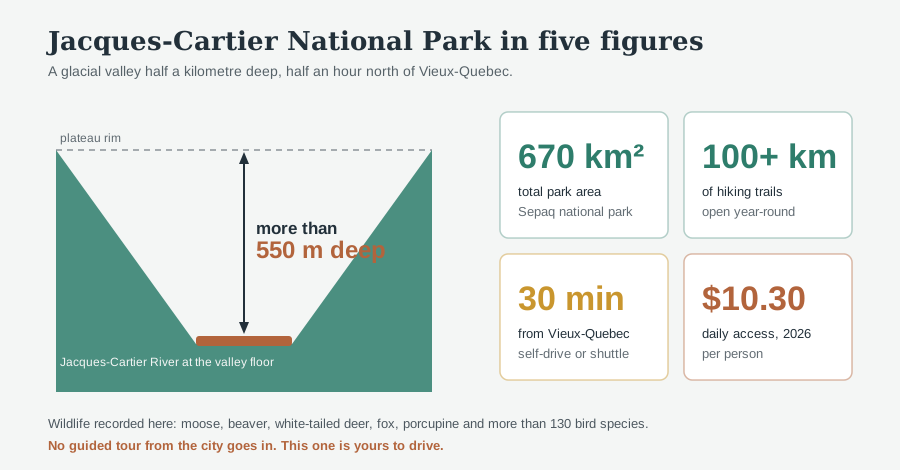
Parc national de la Jacques-Cartier is a 670 km² Sépaq park about 30 minutes north of Vieux-Québec, built around a glacial valley cut more than 550 metres deep. It holds over 100 km of hiking trails and stays open year-round. Daily access in 2026 costs $10.30 per person. Guided hiking and winter snowshoeing departures include transport from Quebec City; independent visitors can drive or check seasonal shuttles.
Ask me on Dufferin Terrace where the wild part of Quebec starts and I will point north, over the rooftops, at nothing you can see from there. Thirty minutes up Highway 175 the strip malls quit, the shoulder narrows, and the road drops into a trench of spruce and birch with a river running through the bottom of it. That is Parc national de la Jacques-Cartier. I send people there constantly. Guided hiking and winter snowshoeing departures now provide an alternative to driving yourself.
TL;DR: Parc national de la Jacques-Cartier covers 670 km² about 30 minutes north of Vieux-Québec, and its glacial valley is cut more than 550 metres deep. There are over 100 km of marked trails, it is open all year, and 2026 daily access runs $10.30 per person. You can drive independently or take a guided hiking or winter snowshoeing departure with city transport. Allow about six to six and a half hours for the guided options, rather than treating them as a short transfer.
How Far Is Jacques-Cartier National Park From Quebec City?
About 30 minutes from Vieux-Québec, roughly 40 km north on Highway 175. That puts it closer to the walls than most city-limits airports are to their downtowns. The park itself covers 670 km², and the Jacques-Cartier River has carved a valley more than 550 metres deep through it.
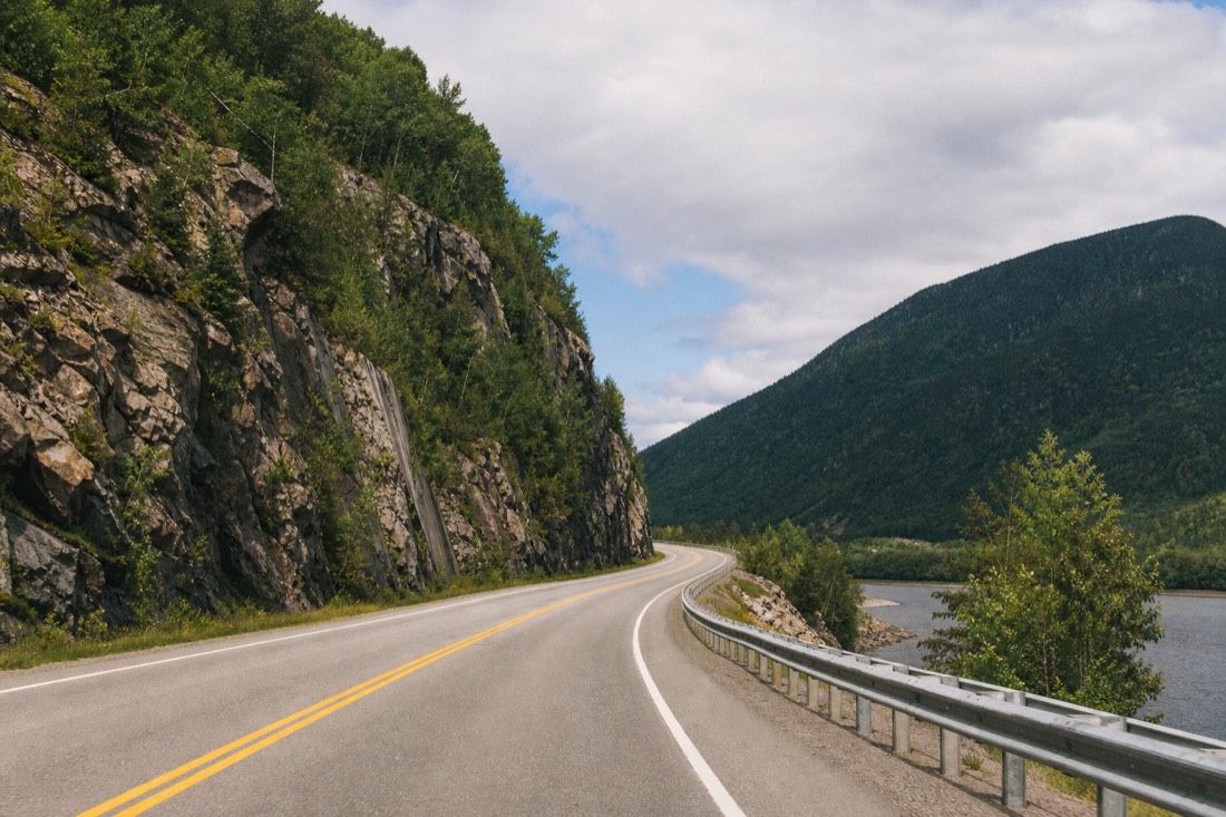
The proximity is the part people refuse to believe. You can finish a croissant on rue Saint-Jean and stand at the bottom of a glacial valley before the caffeine wears off. It is the shortest trip from a UNESCO-listed old town to genuine backcountry I know of on this continent, and it is the reason the park shows up on every honest list of day trips from Quebec City with both independent access and guided activity options.
Depth is what makes the landscape read the way it does. A 550-metre incision means the valley walls climb steeply on both sides of the water, so the light arrives late and leaves early and the weather at the river can differ from the weather on the plateau above. Official park detail sits on the tourism board's Parc national de la Jacques-Cartier listing, which aggregates the Sépaq specifics.
Is There A Guided Tour To Jacques-Cartier National Park From Quebec City?
Yes. Guided hiking and winter snowshoeing trips depart from Quebec City into Parc national de la Jacques-Cartier. The hiking trip includes transport, park entry and lunch; the snowshoeing trip adds snowshoes and a hot drink. They are active outings, so check the physical requirements and the seasonal calendar before booking.
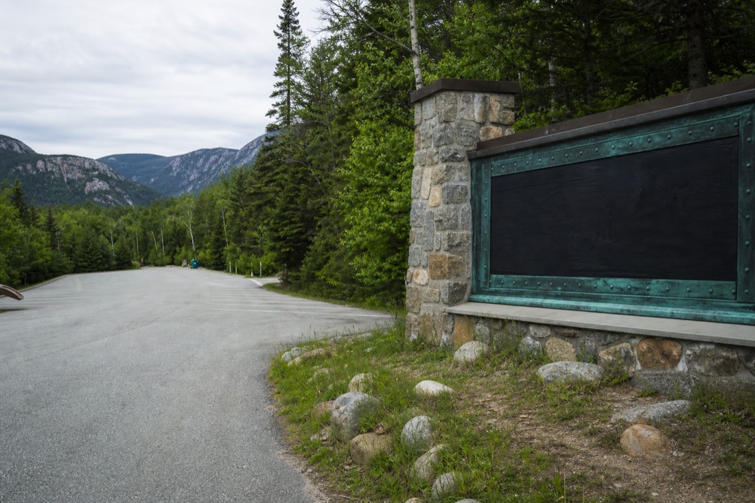
A guided outing solves the return journey as well as the outward drive. It also commits you to the operator’s trail and pace. Independent hiking still makes sense if you want a different route, more time in the valley or a paddling day.
The hiking departure lasts about six and a half hours; the snowshoe outing about six. Neither is a short sightseeing transfer. If your priority is a waterfall viewpoint with less walking, Montmorency Falls tours serve a different kind of nature day east of the city.
| Jacques-Cartier park | The bookable half day | |
|---|---|---|
| Where it goes | 40 km north on Hwy 175, into the glacial valley | East to Montmorency Falls and Sainte-Anne-de-Beaupré |
| Bookable with us | Guided hiking or winter snowshoeing with city transport | Yes, on Viator from $73 |
| Rating and reviews | Check the selected activity’s current listing | 4.2 across 2,909 reviews |
| What you pay on site | $10.30 daily access per person, 2026 | Included in the tour price |
| Best for | Hikers, paddlers, people with a car | No car, limited time, want the famous sights |
| Time needed | Half day minimum, full day better | Half day |
How Do You Get To Jacques-Cartier National Park Without A Car?
A car gives the most flexibility, while guided hiking and snowshoeing departures provide round-trip city transport. There is no year-round city bus to the park gate. Seasonal shuttle services aimed at hikers do operate, and a taxi or rideshare will make the roughly 30-minute run for a fare that climbs fast on the return leg. Check the shuttle schedule before you count on it.
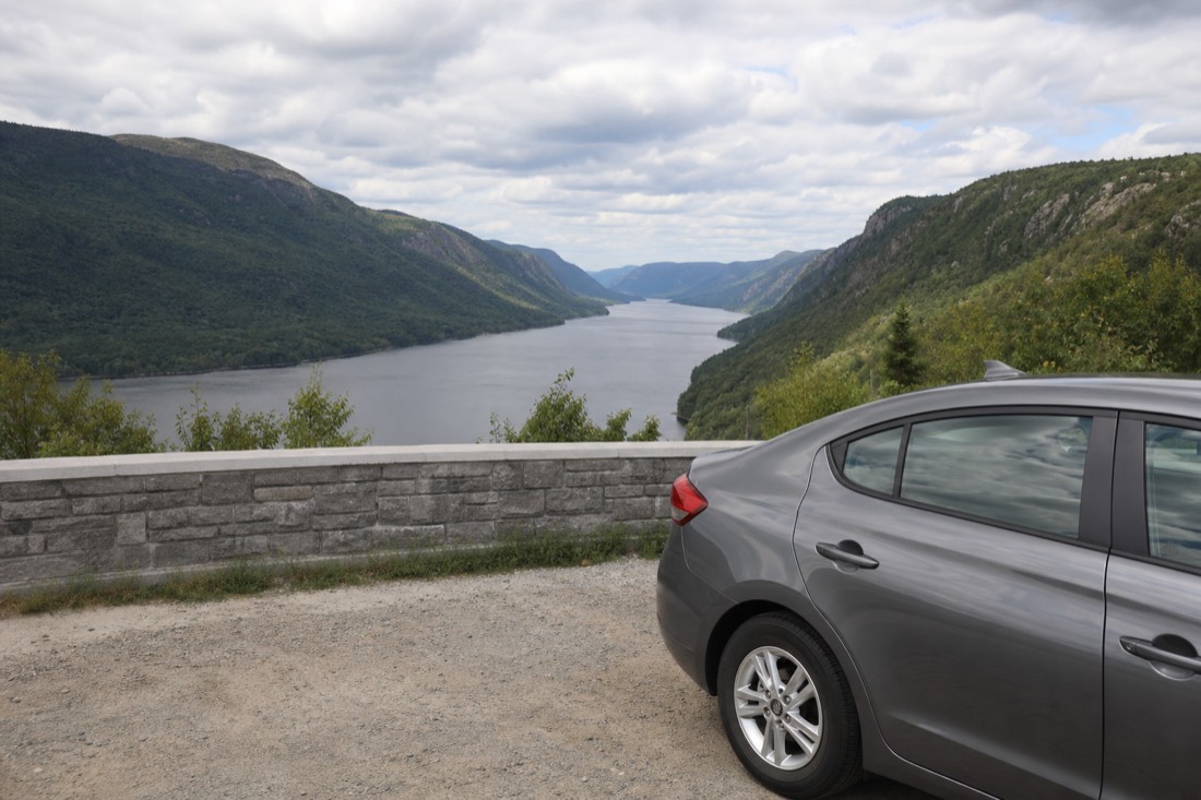
I get asked this weekly and the answer disappoints half the people who hear it. Quebec City's public transport is genuinely good inside the urban area, as our getting around Quebec City guide sets out, and then it stops well short of the park. The city bus network is not a hiking-access network. Once you accept that, the choice is simple: wheels of your own, a seasonal shuttle, or a taxi you have arranged both ways in advance.
| Way in | Time from Old Quebec | What to know |
|---|---|---|
| Rental car | About 30 minutes | The default. Full flexibility on trailheads and on when you leave |
| Own vehicle or camper | About 30 minutes | Parking sits at the sector entrances; arrive early on summer weekends |
| Seasonal hiker shuttle | Same drive, fixed departures | Runs in season only, limited seats, book ahead and confirm the return |
| Taxi or rideshare | About 30 minutes each way | Getting there is easy, getting picked up in the valley is not. Arrange the return before you go |
| City bus | Not available to the park | The network serves the urban area, not the Sépaq gate |
One practical warning that guidebooks skip. Mobile coverage inside a 550-metre valley is not something to bet a ride home on. If you go by taxi, fix the pickup time and place while you still have signal, and take a photo of the trailhead sign so you can name it precisely.
What Is There To Do In Jacques-Cartier National Park, And What Does It Cost?
More than 100 km of hiking trails, canoe and kayak water on the Jacques-Cartier River, and a full winter switch to snowshoeing and skiing. The park is open year-round. Daily access in 2026 is $10.30 per person, and a watercraft-plus-fishing access package was listed at $67.50 for summer 2026.
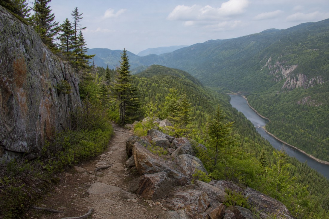
The trail network is the headline, and 100 km is enough to hold a repeat visitor for years rather than a morning. Paddling is the other draw: the river runs through the base of the valley, and being down on the water with those walls on either side is a completely different experience from looking at them from a lookout. Winter does not close the place. It changes it.
Two things to sort before you drive up. First, hours shift by season, so the practical move is checking the current opening times rather than assuming a summer schedule holds in November. Second, the $10.30 is access only; rentals, activity packages and any overnight stay price separately. Sépaq publishes the current figures on its national park pricing page.
| Season | What the park is for | What you pay |
|---|---|---|
| Summer | Hiking the 100-plus km network, canoe and kayak on the river | $10.30 daily access; watercraft and fishing access listed at $67.50 for summer 2026 |
| Autumn | The valley walls turn colour and the trail traffic thins | $10.30 daily access |
| Winter | Snowshoe and ski terrain; the park stays open | $10.30 daily access; equipment rates on the Sépaq page |
| Spring | Melt, high water and mud on the lower trails | $10.30 daily access |
| Any season | Rentals, packages and overnight stays | Priced separately from access, current rates on the official site |
Autumn deserves its own note. The colour in a steep-walled valley behaves differently from colour on flat ground, because you see the whole gradient at once from the bottom to the ridgeline. If your dates are flexible, our Quebec City in fall piece covers when the region turns, and the same window is the best of the year up here.
What Wildlife Lives In The Jacques-Cartier Valley?
Moose are the animal people come hoping for. The park also holds beaver, white-tailed deer, fox and porcupine, along with more than 130 bird species recorded within its boundaries. Nothing is guaranteed on a single afternoon walk, and the odds improve enormously at the quiet ends of the day.
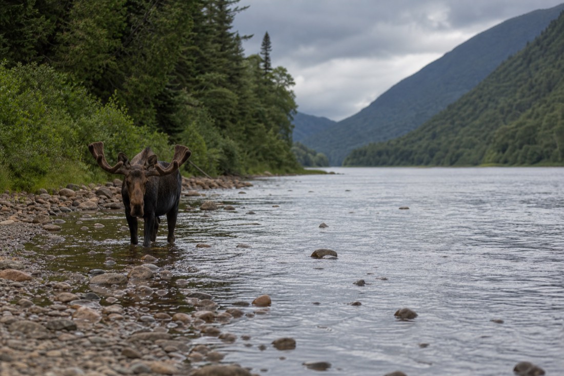
A moose is a genuinely large animal, and the first reaction of most visitors who meet one is to underestimate the size until it moves. Keep your distance, stay on the trail, and treat a sighting as luck rather than an itinerary item. The bird count is the number I find more telling: 130-plus species in one valley points to a range of habitats stacked between the river and the plateau, wetland at the bottom and boreal forest climbing the walls.
This is also the honest limit of what a guide can promise you. I will not tell you that you will see a moose, because I cannot, and anyone who does is selling something. What I will say is that the people who see wildlife here are usually the ones who came early, walked slowly, and stopped talking for ten minutes at a stretch.
What Does A Self-Drive Day At Jacques-Cartier Cost?
Daily access is $10.30 per person in 2026, so $20.60 for two adults, and that is the entire compulsory spend. A watercraft-and-fishing access package was listed at $67.50 for summer 2026, which takes a paddling day to $88.10 for two. Everything else is the car, the fuel and the sandwiches.
For a park half an hour from a UNESCO old town, those are startling numbers. Two people can walk marked trails all day inside 670 km² of protected valley for less than the price of two coffees and a pastry on rue Saint-Jean. That is the argument for the place, and it is the reason I keep sending guests north, whether they drive themselves or join a guided activity.
The drive is where the real money sits. Forty kilometres each way is an eighty-kilometre round trip, cheap in fuel and expensive in rental if you are hiring a car for this alone. That single decision, whether the car exists anyway or is being rented for the day, moves the total more than every on-site fee combined.
Compare it honestly with the guided alternative and the gap is wide: the bookable half day to Montmorency Falls and Sainte-Anne-de-Beaupré is $73 USD per person, so $146 USD for a pair, and it takes you somewhere else entirely. You are paying for a driver, a route and a fixed return time. Up here you are paying $10.30 and doing all three yourself.
| Line item | Two adults, walking day | Two adults, paddling day |
|---|---|---|
| Daily park access, 2026 | $20.60, at $10.30 each | $20.60 |
| Watercraft and fishing access | n/a | $67.50 as listed for summer 2026 |
| Equipment rental | n/a | Priced separately on the Sépaq page |
| Car | Your own, or a rental: varies | Same |
| Fuel, roughly 80 km round trip | Varies with the vehicle | Varies with the vehicle |
| Food and water | Bring it; confirm on-site services before counting on them | Same |
| Compulsory on-site total | $20.60 | $88.10 |
What Should You Pack For A Day In The Jacques-Cartier Valley?
Layers, real footwear, food, water and a downloaded map. Mobile coverage at the bottom of a 550-metre valley is unreliable, weather on the river can differ from weather on the plateau above, and the park is open year-round, so the packing list swings hard between August and February.
The depth of the valley is not a scenic detail, it is a planning fact. Steep walls mean the sun arrives late and leaves early at river level, so an afternoon that felt warm on the highway can be ten degrees less pleasant once you are down among the spruce. Carry the layer you think you will not need. On the way back up to the plateau you will be glad of it, and the drive home at dusk is better with dry clothes on.
Winter changes the list rather than shortening it. The park stays open and switches to snowshoe and ski use, which means traction, wind protection and a much shorter daylight budget. Nobody wants to be finishing a trail by phone torch in a valley where the light goes early anyway.
Two items that are not gear and matter more than gear. First, a screenshot of the trail map and the sector entrance name, taken while you still have signal. Second, a plan for the return trip fixed before you leave town, particularly if a taxi is involved. The table is a planning allowance, not a Sépaq requirement.
| What to carry | Summer | Winter | Why |
|---|---|---|---|
| Boots with grip and ankle support | Essential | Essential, plus traction devices | Over 100 km of trail, and valley walls climb steeply |
| Spare warm layer | Yes | Several | River level runs cooler than the plateau above |
| Rain shell or wind layer | Yes | Yes | Weather can differ top to bottom of the valley |
| Water and food for the day | Yes | Yes | Confirm current on-site services before relying on them |
| Offline map screenshot | Yes | Yes | Mobile coverage 550 metres down is not dependable |
| Head torch | Sensible | Essential | Daylight leaves a steep valley early |
| Binoculars | Optional | Optional | More than 130 bird species recorded here |
| Insect protection | Worth it in summer | n/a | Wetland at the river bottom, forest above |
How Does Jacques-Cartier Compare With The Other Nature Days From Quebec City?
On cost, nothing near the city beats it: $10.30 buys a whole day in 670 km² of valley. Montmorency Falls is closer and cheaper to look at, Canyon Sainte-Anne is the seasonal gorge walk at $15 for adults, and guided hiking or snowshoeing makes Jacques-Cartier possible without your own car.
Read the ladder by what you want out of the day rather than by price. An hour of spectacle with no planning points you at Montmorency, fifteen minutes and thirteen kilometres out on the Beaupré road, where adult access is $6.95 and the cable car $14.95. A longer walk with bridges over a chasm points you at the canyon, though it runs 7 May to 25 October 2026 only, so winter takes that option off the table entirely.
Jacques-Cartier is the one that asks the most of you and gives the most back. There is no ticket queue, no headline photograph everybody already has, and you can choose an independent trail or follow a guided activity schedule. What there is: over 100 km of trails, a river to paddle, and 130-plus bird species in a valley cut half a kilometre deep, all of it thirty minutes from the walls.
The food-first alternative sits in a different direction again. Île d'Orléans is twenty minutes to the bridge and its guided taste trail runs from $62, which is a day about producers rather than terrain.
| Day out | Drive from Old Québec | On-site cost per adult | Bookable in our lineup | Suits |
|---|---|---|---|---|
| Montmorency Falls | About 15 minutes, 13 km | $6.95 access, $14.95 cable car | Yes, half day from $73 USD | First-timers with no car and one free morning |
| Jacques-Cartier park | About 30 minutes, 40 km north | $10.30 daily access, 2026 | Yes, guided hiking or winter snowshoeing; independent access also possible | Hikers, independent paddlers and visitors choosing an active guided day |
| Canyon Sainte-Anne | About 35 minutes | $15 adult, $10 ages 6 to 17 | Not a listed stop on the coach tour | Gorge walkers, 7 May to 25 October 2026 only |
| Île d'Orléans | About 20 minutes to the bridge | Whatever you eat | Yes, taste trail from $62 | Food-led days with no hiking in them |
| The park plus anything east | Two directions in one day | Both sets of fees | n/a | Drivers who would rather cover ground than stop |
Half Day Or Full Day: How Long Does Jacques-Cartier National Park Need?
A half day works if you drive straight up, walk one marked trail and come back. A full day is the version worth planning, because 30 minutes of driving each way is cheap against 100 km of trail. Anything shorter than four hours total turns the park into a viewpoint stop.
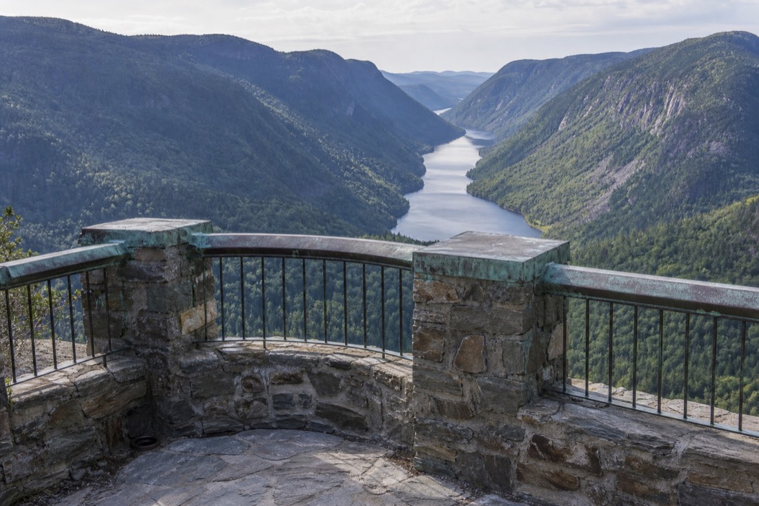
Most visitors underestimate how much of a day the valley absorbs once they are in it. The trails climb, the light changes, and the drive back down the 175 at dusk is genuinely good. If your trip is short and packed, the smarter call may be pairing the park with nothing else at all rather than squeezing it between two city sights.
| Plan | Rough shape | Suits |
|---|---|---|
| Half day, morning | Leave by 8, one short trail or a lookout loop, back for lunch in town | Tight itineraries, one free morning, families with small kids |
| Half day, afternoon | Up after lunch, riverside walk, back for dinner | Late risers, hot summer days, anyone chasing evening light |
| Full day, hiking | Early start, one long trail plus a second short one, picnic at the river | Walkers who came for the trails, autumn colour trips |
| Full day, paddling | Access package, morning on the water, short walk after | Canoe and kayak people, summer only |
| Two-park day | The park plus a stop on the way back toward the city | Drivers happy to keep moving, longer daylight months |
For the trip that mixes wilderness with something else, look at the geography before the schedule. The park runs north; the other big scenery days run east, and Canyon Sainte-Anne or the longer drive out to Charlevoix sit on that side of the map. Two of those in one day is a driving day, not a nature day. Official regional planning material lives on the Québec City tourism site, which is the place to cross-check seasonal opening before you commit a morning.
Is there a tour from Quebec City to Jacques-Cartier National Park?
Yes. Guided hiking and snowshoeing departures include return transport from Quebec City. Choose the seasonal activity and check its physical and meal requirements; driving independently or taking a seasonal hiker shuttle remains another option.How much does it cost to enter Jacques-Cartier National Park?
Daily park access rights for 2026 are $10.30 per person. Activity packages price on top: a watercraft and fishing access package was listed at $67.50 for summer 2026. Rentals and overnight stays are separate again.Is Jacques-Cartier National Park open in winter?
Yes. The park is accessible year-round and switches to snowshoe and ski use in winter. Opening hours vary by season, so check the current schedule for the week you travel.How long is the drive from Old Quebec to the park?
About 30 minutes, roughly 40 km north on Highway 175. It is one of the shortest runs from a walled UNESCO old town to real backcountry anywhere in North America.Can you see moose in Jacques-Cartier National Park?
Moose live in the park, along with beaver, white-tailed deer, fox, porcupine and more than 130 bird species. Sightings are luck, not a schedule. Early morning and late evening on quiet trails give you the best chance.The valley does something that no walking tour of mine can replicate, and I say that as somebody whose whole job happens inside the walls. Down at the river, with 550 metres of rock and spruce standing over you, the city you left half an hour ago stops feeling like the main event. Then you drive back, and the Frontenac lights up over the water, and both things are true at once.
Your Next Step
Choose Your Quebec Experience
General recommendation, before you add preferences. Confirm dates and participation requirements with the operator.
Have your travel date in mind? Trade the rental-car logistics for a guided national-park hike with Quebec City transport, park admission and lunch. Check the departure before arranging the rest of your day.
6 hours 30 minutes. Lunch cannot accommodate gluten-free, lactose-free or vegan diets according to the listing; hiking demands apply.
Departure schedule from Viator; final availability and price are confirmed on Viator.
Compare Options And Fit Your Plans
Trade the rental-car logistics for a guided national-park hike with Quebec City transport, park admission and lunch. 6 hours 30 minutes. Lunch cannot accommodate gluten-free, lactose-free or vegan diets according to the listing; hiking demands apply.
Explore the snowy forest with a guide, snowshoe equipment, round-trip transport and lunch included. 6 hours overall, including the journey. This is an active winter excursion; check the conditions and participation requirements.
See the waterfall from above and below with the park’s cable-car visit. Park admission, round-trip cable car, terminal parking and local taxes included. Arrange your own transport. Zipline and via ferrata are separate. Allow three hours including your own city-to-falls return journey. This is a planning allowance, not a fixed ticket duration.
Affiliate links: we may earn a commission at no extra cost to you.